
Oconto Falls is your Destination to Outdoor Recreation.
The Oconto Falls area has trails for everyone, whether you’re a silent sports enthusiast who craves the solitude of nature or an ATV/UTV/snowmobile rider out for a heart-pumping ride. The trails located in the Oconto Falls area demonstrate how a diverse group of volunteers, organizations, local leaders, and government officials can work together to develop recreational opportunities for local residents and visitors. Map and information about the Oconto Falls Area Trails.
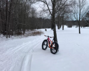
Fitness/Mountain Bike/Fat Tire Trail
Just steps from South Main Street you can connect with nature on the wooded, multi-use trail adjacent to River Island Golf Course on the city’s southeast side. The 4-mile trail can be enjoyed in all four seasons: hiking, running, and biking. The trailhead is at the wooded corner of the open lot at the intersection of River Island Drive and Mead Avenue. Information about the trail is available on Facebook.
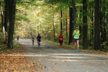
West Side Beach Walking Trail
Experience the peacefulness and beauty of nature with a walk along the West Side Beach Walking Trail. The short, half-mile trail takes you on a path along the river and into the woods. Satisfy your desire to get away from city life by taking a quick excursion, either walking or jogging the forested path. A portion of this path is used for the annual Trick or Treat Trail held every fall.
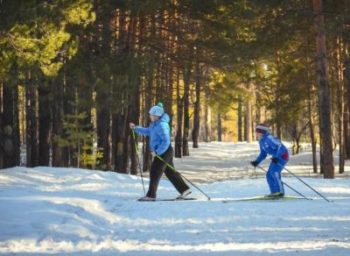
Machickanee Forest Ski Trails
The wooded trails of Oconto County’s Machickanee Forest offer the opportunity for nature-oriented outdoor entertainment in the winter. The Machickanee Cross Country Ski Club maintains a system of ski trails for beginner and intermediate skiers. The trails are groomed for classic skiing (skate skiing is discouraged) and vary in length from 1 to 4 miles. The trail is located in the town of Abrams, approximately 5 miles from Oconto Falls. Parking is available at two separate trailheads. Donations are welcome.
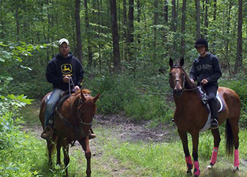
Machickanee Forest Equestrian Trails
For those who enjoy spending their day in the saddle, the Machickanee Forest Equestrian Trails are free to use. The 25 miles of marked trails are open from April 15-Nov. 10. The terrain through the county forest is mostly sandy and flat, with some water obstacles. Trails meander through red pine plantations, birch and aspen stands, and oak ridges. Truck and trailer parking is available in two areas, and camping is available with a permit. The Outback Riders maintain the trail, which is located in the town of Morgan, approximately 5 miles from Oconto Falls.
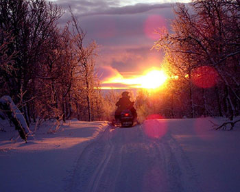
Snowmobile Trails
An excellent antidote to cabin fever, snowmobiling is a fun sport and fantastic winter activity. Get a group of family members or friends together for socializing and trail-riding on the roughly 60 miles of snowmobile trails in central Oconto County. Maintained by the Oconto Falls Sno-Jokers snowmobile club, the scenic trails meander through the Machickanee Forest, along the Oconto River, and across farm fields. Travel to your favorite restaurants in the Oconto Falls area on the marked routes open to snowmobile traffic. Check the Sno-Jokers website for trail conditions. Always ride safely, and stay on the trails.

ATV/UTV Trails
Oconto County is known for its hundreds of miles of interconnected ATV/UTV trails, perfect for scenic riding through forests and countryside. The city of Gillett, just a short drive west of Oconto Falls, is the southern end of the 90-mile, multi-use Nicolet State Trail that attracts many ATV/UTV recreational riders. Check out the routes in the City of Oconto Falls and throughout Oconto County.